Wiltshire - Swindon to Salisbury, 07 April 2007Back to pictures
07 April 2007
8 am, time to run and catch a train at Paddington. I sort of know the way there. I'm ok most of the way there, I make it to Chelsea Bridge without much trouble. I've been that way a few times, I kind of remember it. Crossing the river, it is a bit foggy and hazy out. On the north side of the river, I'm a little less sure. I check the map a number of times and make my way through Hyde Park and through some winding streets until I find the station.
It takes me 40 minutes to get there, pretty good time. And a bit of relief since I don't have my tickets yet. Well, I've bought them, but never received them. It just wouldn't be a journey by rail if the tickets weren't messed up somehow. I've already had to go to great lengths to get them. Being a bank holiday weekend, it means the trains are a mess. I'm headed towards Swindon (well, Warminster) and will ride to Salisbury mostly because it wasn't possible to get a train to Salisbury that didn't have some sort of bus replacement (i.e., you want to take a bike on the bus, ha).
So, to the station in plenty of time to sort this out. I try three different ticket offices before I finally find the one who has my tickets waiting. Of course they are messed up. Cycle reservations, not in the packet, so the ticket lady writes me a hand written note saying that I did actually have cycle reservations but that computer problems prevented them from printing out correctly. Ok, I guess, whatever works. So, ticket mess and cycle reservation problems out of the way for the trip then, umm, sort of, but that is skipping way ahead.
Train comes, get my bike loaded into the guard car, find my seat, and we are off. Swindon is only an hour away. It drops me off about 50 miles north of Salisbury. Well, an hour and a half before the train to Bath, switching there to another one to Warminster would take. And I would still be like 20 miles away from Salisbury.
I assemble stuff on the platform in Swindon as the train pulls off. Hopefully I did the right thing here since there goes my train. My ticket confuses the guard on the way out of the station, but I tell her I got off early and she lets it slide.
It is always the first step that is the hardest. Well, coming out of the station, I have no idea where I am, which way is which and how to get to where I want to go. Compass, ok, I guess it is sort of that way. Big towns are a pain with OS maps, they are fantastic in the country but there is not enough detail (or street names) to navigate through towns. I want that yellow road that goes here on the map down that way to there. In reality, I end up going in a circle before I just decide to go south on whatever street until I end up somewhere kind of out of town and then I can figure out where I am on the map.
I guess that works ok, I finally then find some road that looks right, although I miss the stone circle marked on it. Oh well, I guess I'll see other ones on the trip. Umm, traffic too, it is driving me a bit crazy. Getting onto the Ridgeway is a real relief. Ok, it is a bad road, but it isn't awful traffic. It is rocky and bumpy and I'm on a road bike. My poor Condor, so mistreated.
It is slow going, can't go all that fast on the road and it takes a lot of concentration to avoid the huge rocks and holes and ruts. (I totally didn't realize at this point that it would get so much worse.) The country side is beautiful though. Rapeseed is blooming all over the place and there are large patches of yellow. Many of the fields are freshly plowed too and they are really interesting to go past. So much of the area here is on chalk, the fields kind of glisten with up turned rocks, a texture of brown dirt and white rocks. The weather is nice too, not too hot but fairly warm, and birds are flying all over.
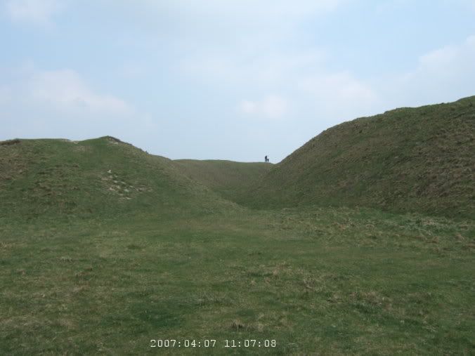
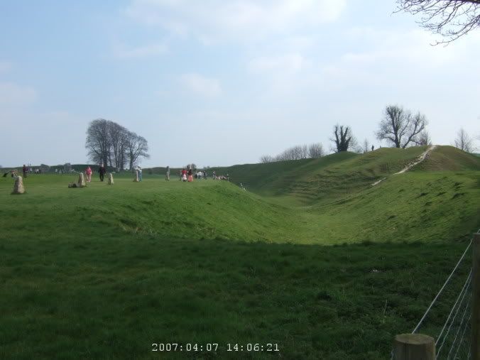
I soon come around a ridge and see lots of cars parked. The Ridgeway crosses a small road here and people are parked to go see Barbury Castle. It is an old Iron Age, I think, earthenwork fort at the top of a hill. I debate going to see it, my bike is a bit loaded down and it looks kind of steep, but I came all this way to see things like this so it is silly not to. It isn't too bad of a hike, pushing my bike up to the top. It is two rings of ridges, with a gully in between and a large flat plateau in the middle. There are a number of people walking around lip of the ridge and I do too. The view is rather nice of the surrounding countryside, a bit hazy though.
I sit halfway around and snack on a few things and consult the map. I'm a little concerned, the road so far hasn't been all that easy and there is a ways to go before I get to normal roads. But at this point, there isn't a lot of other ones that are not a large detour out of the way. So, I keep going. There are not all that many people on this road. Considering how many were at the castle and that this is the first bank holiday weekend of the summer, but there are occasional mountain bikes going by, but not much in general. Some guy does pass me, also a mountain bike but the only one I've seen so far with any sort of baggage on it. He says I'm a bit brave for trying this on my bike. (Perhaps he was being polite by not staying stupid.) A little further on, the road gets pretty awful. The rocky road was difficult but just going over grass with lots of really deep grooves and ruts, with a bike with fairly skinny tires and somewhat heavy bags on the back, I nearly fall once when I get stuck in a groove and can't quite get my cleats out in time.
I reach the turnoff for the Wessex Ridgeway, I'm on the home stretch to Avebury now. The road gets somewhat better and is mostly downhill. Then it gets positively better and I find myself around loads of people walking across the street, following the circle of stones around the town.
Avebury is surrounded by, I guess, the largest set of standing stones, in the world, or something. Most of the village is enclosed by them, along with a henge. I can't see all that much from where I am, just a few scattered stones and lots of people milling around. A church ahead, well, looks to be a tourist information center in a former church. I stop to check it out. Then it is a bit past lunch time and I'm rather hungry and I don't see another candidate for lunch on the map anywhere in the near future.
The pub in town is extremely busy, the parking lot is full and the guy says it will take 45 minutes for food. It doesn't seem like I have all that much choice. They are out of mash, so that dashes the idea of sausage and mash, which is normally a pretty safe pub choice. So, I guess the burger then. Which takes an hour and really sucks. The pub in generally looks pretty crappy but I guess considering their location, it doesn't matter, they probably still make money.
Feeling not so great from the lousy food, I go and wander around the town a bit, seeing the stones and all. It is a bit hard to appreciate them all, the scale is just so huge. You can't see the entire formation because there are buildings and a town all around them. And it is packed too. So, I wander on then. The Stone Avenue which heads out of town for a mile or so is rather cool, a twin line of stones headed off to another site.
I keep heading south on some smaller roads. Traffic isn't so bad here and it is nice making good time. I come up to another roadside parking lot and wonder what it is. Well, I saw people off in the distance hiking up a hill before I got there. I sort of figure out it is Knap Hill but I can't figure out what people are going to see (until I got home and saw it has barrows at the top.) I'm amused by the sign that says "Knap Hill has never been and never will be a site for hang gliding" as I see some guy hang gliding off in the distance. Guess he didn't read the sign.
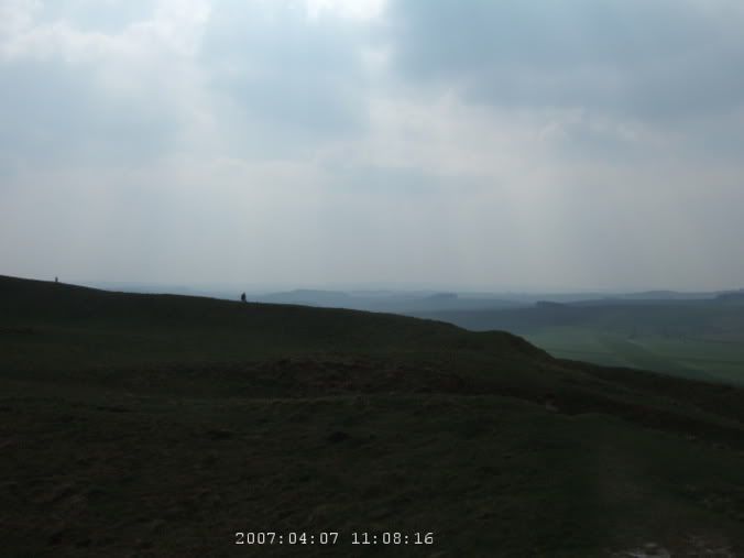
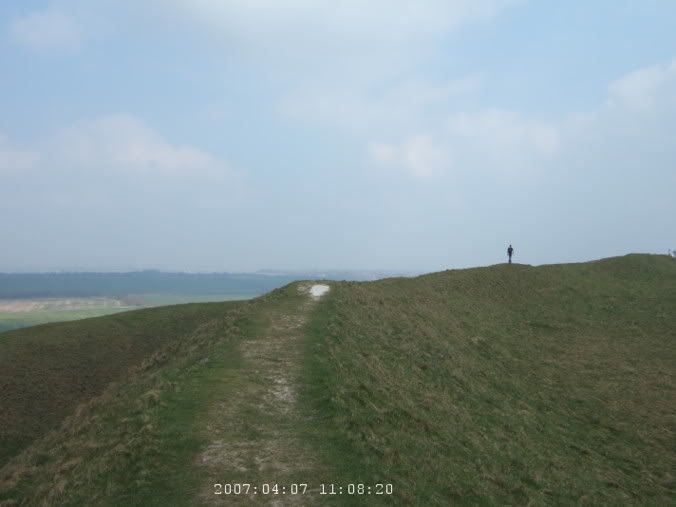
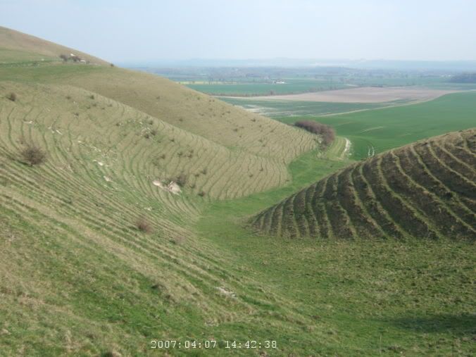
The land around here is pretty cool though. The hills have this really cool texture, like rippling ridges, sort of like a topographical map come to life, the little contour lines, lines across the hills. I wonder what makes them form like that. I keep going, head through Pewsey (which is where I will take the train out in a few days) and at the south side of town, I see the white horse carved in the hill ahead. The really steep hill I'll have to climb.
But I've decided the whole white horse thing is stupid. This whole area has a white horse trail, which I guess connects the various white horses. I have nothing against them, the man carved near Wilmington, in Sussex, I think, is pretty cool because it is pretty distinctive and is actually rather old. But at one point I see a sign highlighting the various horses in Wessex and none of them are more than 100 years old. Some of them were carved less than a few years ago. Something about that strikes me as annoying.
But steep climb, Pewsey Hill is a big climb and there wasn't even a nice vantage point to stop and enjoy the view once I got to the top. Still, I sat and rested for a little bit. I did realize something there as I went through my snacks. Baklava wrapped in foil is bad. Not because it doesn't taste good, it tasted very nice, but foil is rubbish for holding sticky liquids (or solids that are covered with sticky liquids). Should have been in a plastic bag. My stuff was sticky for the next few days.
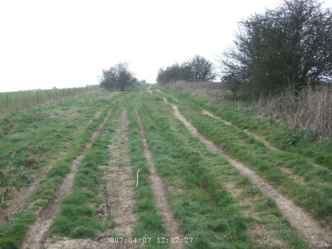
Then probably my favorite part of the ride for the day. Past Everleigh, most of this area is owned by the military and I pass 10-15 tank crossings. Didn't see a tank though. But then like five miles or so into Haxton, straight quiet road, slightly downhill, just lovely. And a half dozen or so paratroopers come floating down into a nearby air base.
About now, I'm getting a bit tired. There is a B road that follows the Avon but I get frustrated and it winds so much, I can't quite figure out which way I should be going on it, so I give up and just take the A road, which is busy but at least it goes straight and I have a pretty good idea where I'm going. I get really frustrated in Amesbury as I try to find the B road again and end up going in circles way on the outskirts of town and the route seems to be going into some new residential area and doesn't seem to be a through street, so I give up and follow the signs into the center of town and just follow the main road again. It is even busier and is driving me crazy but I'm too tired to go out of my way to find a side road. I'm relived when I get to Salisbury and go past Old Sarum (can't see it from the road but at least I know where it is and I can come back).
The B&B is slightly easier to find that I feared it might be, it is pretty central. They let me put my bike in the garage and I have a nice cup of tea before I go wandering to find some food. I look at a lot of menus and places before I finally give up and just go into one. It isn't fantastic but I guess it was good enough. I wander down by the cathedral, in the dark, and it is pretty in lit up. Back to the room and I collapse for the night, although the pillow seemed to have some perfume or something on it and it started getting to me in the morning. But I guess like 63 miles today, 7 or so of that in London and probably like 15 or 20 on those really bad roads which were quite tiring. So, I deserve a nice sleep then.
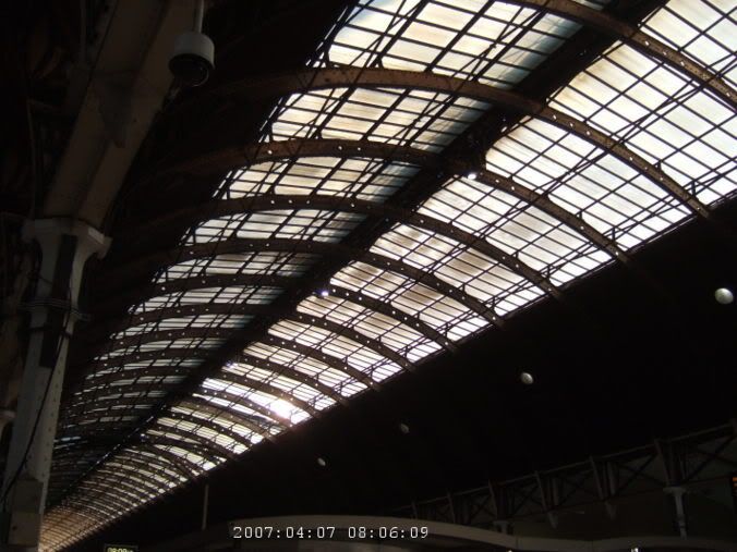 Waiting in Paddington Station.
 Off the train in Swindon.
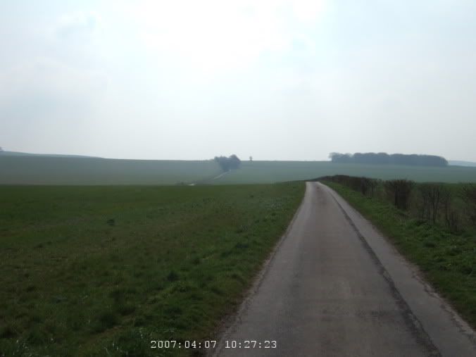 Finally out of Swindon and into the countryside.
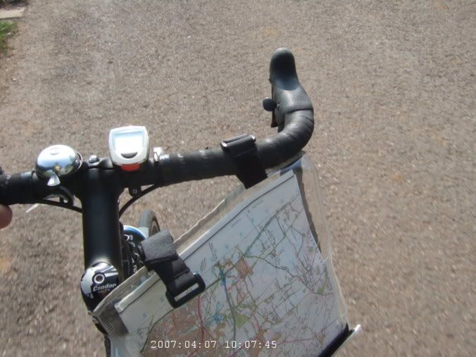
 Road isn't so bad so far.
 Fields of rapeseed.
 Heading up Barbury Castle. Link
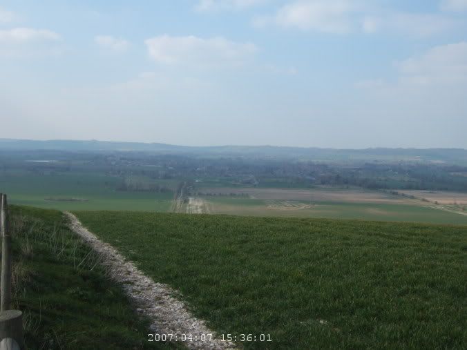
 View at the top of Barbury Castle.
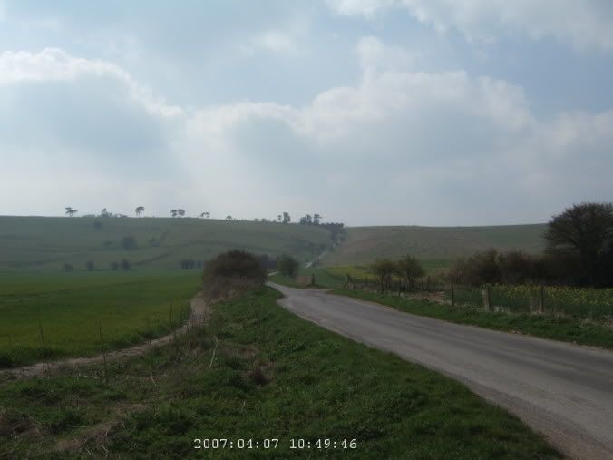
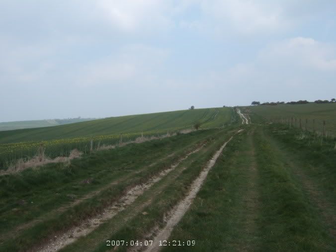
 Rough going here.
 Even more difficult road.
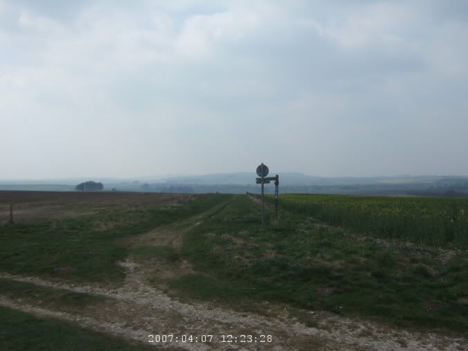 Turn off for the Wessex Ridgeway and to Avebury.
 At the tourist infomation center (old church) in Avebury.
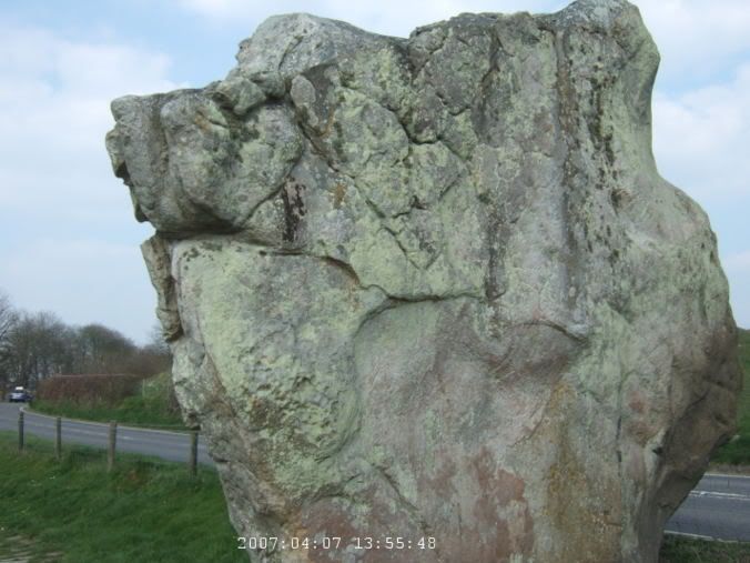
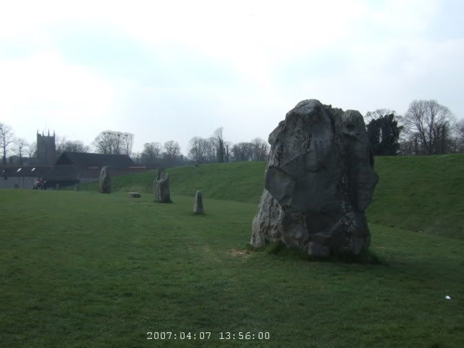
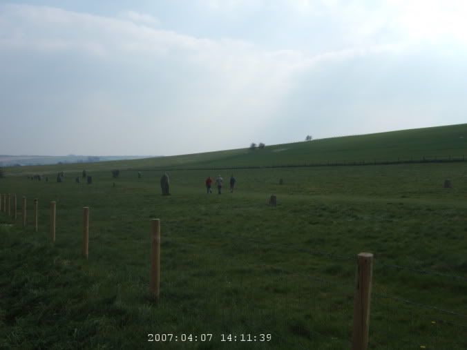
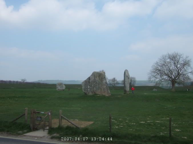 The entire village is ringed by standing stones. Link. Older than Stonehenge and much larger.

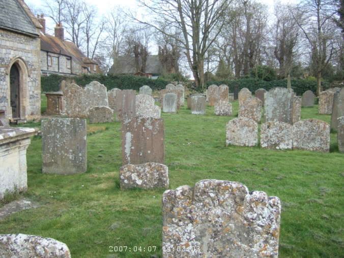 Avebury St. James church.
 The Stone Avenue, runs for more than a mile.
 Past Knap Hill. Link

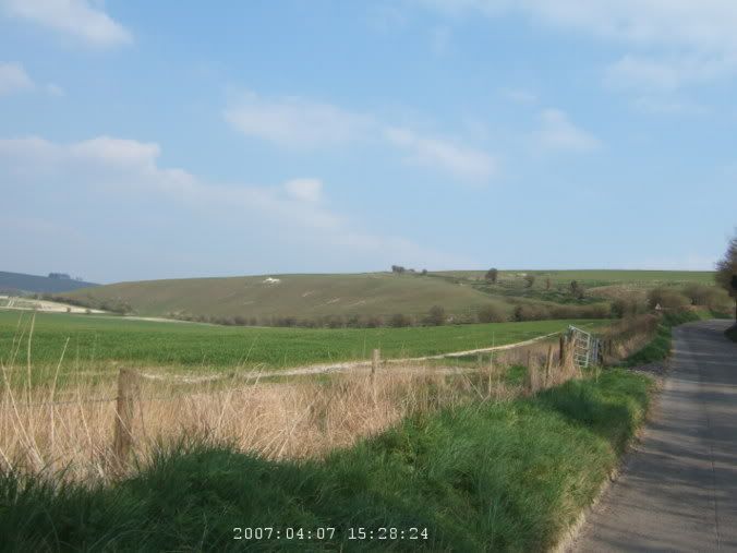 The white horse of Pewsey. And the steep climb which I'm heading towards.
 Above the white horse.
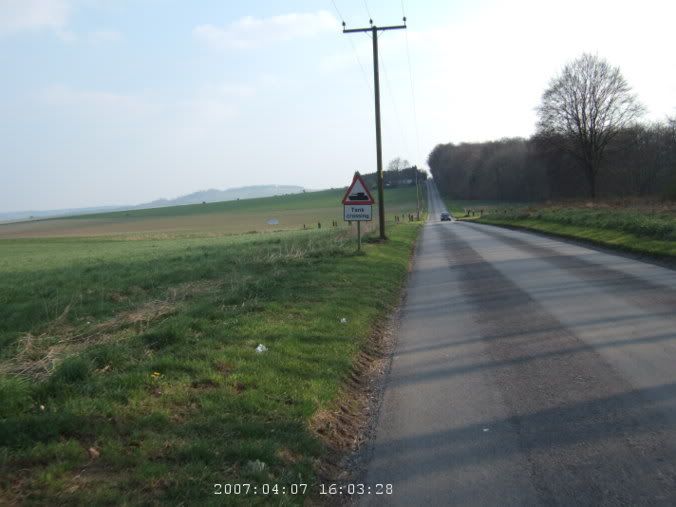 Tank crossing past Everleigh.
 Ahh, a fabulous stretch before Haxton.
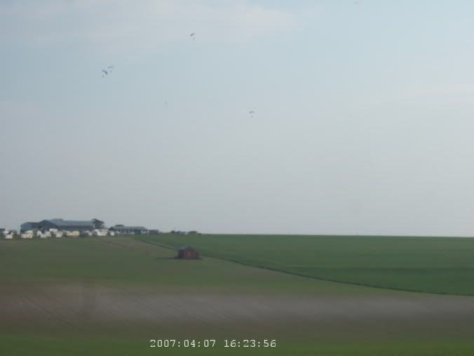 Paratroopers over the RAF air field.
 Around Salisbury.
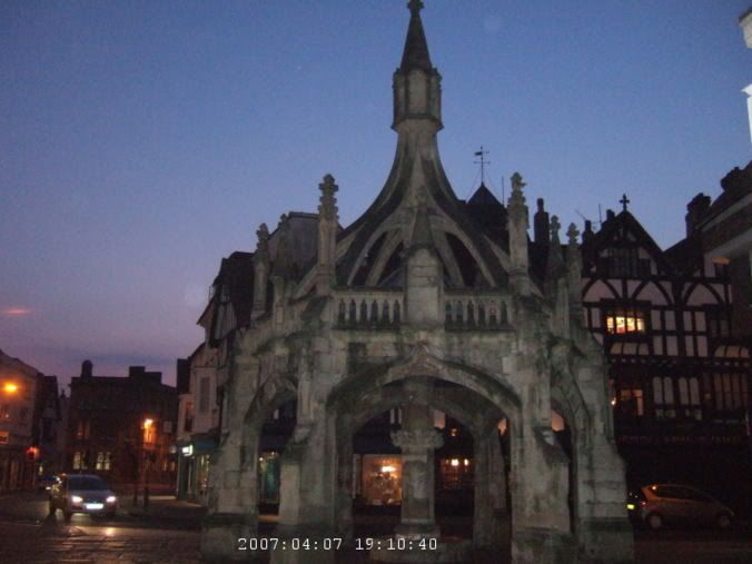
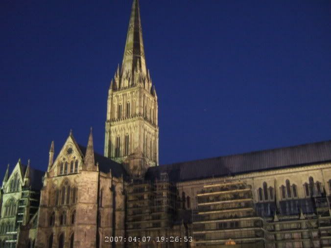 Salisbury Cathedral. Link
