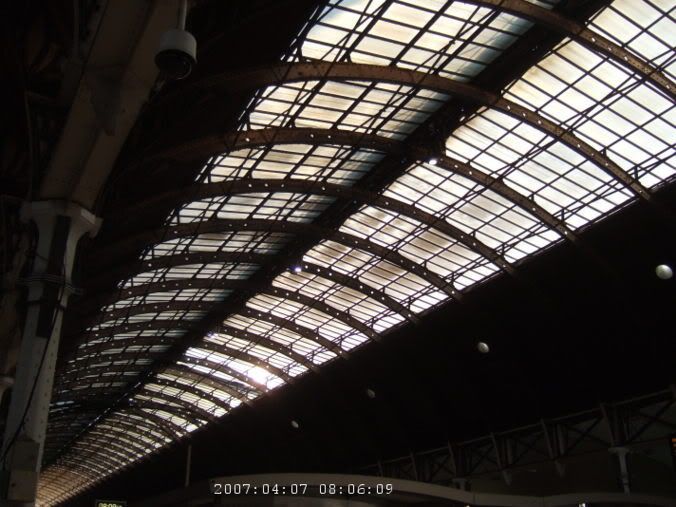
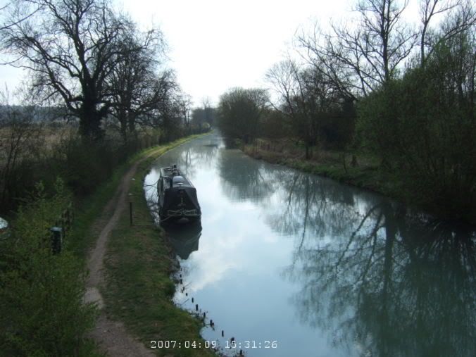
 Waiting in Paddington Station.
8 am, time to run and catch a train at Paddington. I sort of know the way there. I'm ok most of the way there, I make it to Chelsea Bridge without much trouble. I've been that way a few times, I kind of remember it. Crossing the river, it is a bit foggy and hazy out. On the north side of the river, I'm a little less sure. I check the map a number of times and make my way through Hyde Park and through some winding streets until I find the station.
Waiting in Paddington Station.
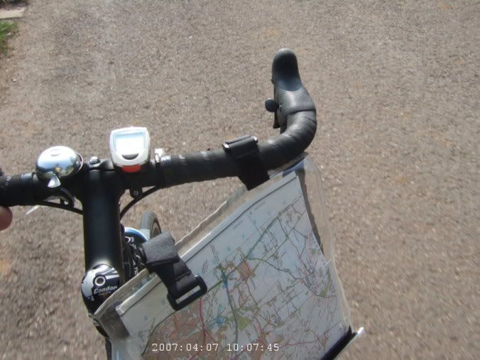
It takes me 40 minutes to get there, pretty good time. And a bit of relief since I don't have my tickets yet. Well, I've bought them, but never received them. It just wouldn't be a journey by rail if the tickets weren't messed up somehow. I've already had to go to great lengths to get them. Being a bank holiday weekend, it means the trains are a mess. I'm headed towards Swindon (well, Warminster) and will ride to Salisbury mostly because it wasn't possible to get a train to Salisbury that didn't have some sort of bus replacement (i.e., you want to take a bike on the bus, ha).
So, to the station in plenty of time to sort this out. I try three different ticket offices before I finally find the one who has my tickets waiting. Of course they are messed up. Cycle reservations, not in the packet, so the ticket lady writes me a hand written note saying that I did actually have cycle reservations but that computer problems prevented them from printing out correctly. Ok, I guess, whatever works. So, ticket mess and cycle reservation problems out of the way for the trip then, umm, sort of, but that is skipping way ahead.
Train comes, get my bike loaded into the guard car, find my seat, and we are off. Swindon is only an hour away. It drops me off about 50 miles north of Salisbury. Well, an hour and a half before the train to Bath, switching there to another one to Warminster would take. And I would still be like 20 miles away from Salisbury.
 Off the train in Swindon.
 Finally out of Swindon and into the countryside.
I assemble stuff on the platform in Swindon as the train pulls off. Hopefully I did the right thing here since there goes my train. My ticket confuses the guard on the way out of the station, but I tell her I got off early and she lets it slide.
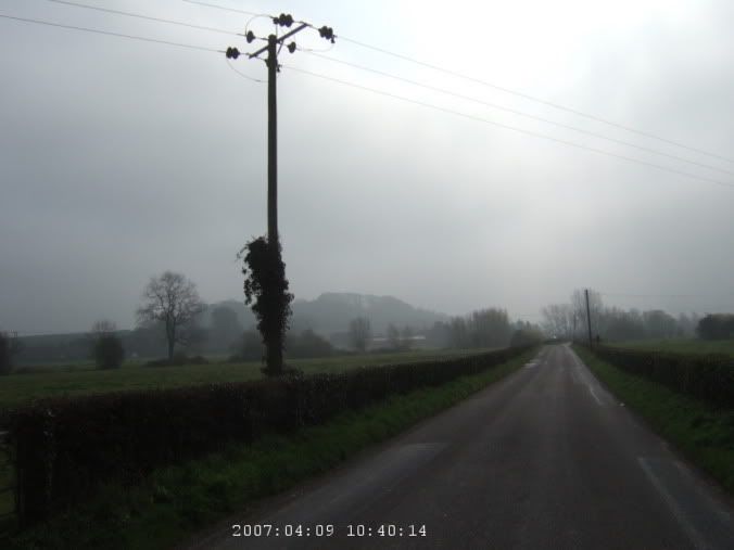
It is always the first step that is the hardest. Well, coming out of the station, I have no idea where I am, which way is which and how to get to where I want to go. Compass, ok, I guess it is sort of that way. Big towns are a pain with OS maps, they are fantastic in the country but there is not enough detail (or street names) to navigate through towns. I want that yellow road that goes here on the map down that way to there. In reality, I end up going in a circle before I just decide to go south on whatever street until I end up somewhere kind of out of town and then I can figure out where I am on the map.
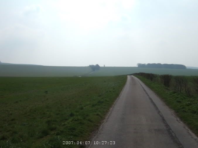
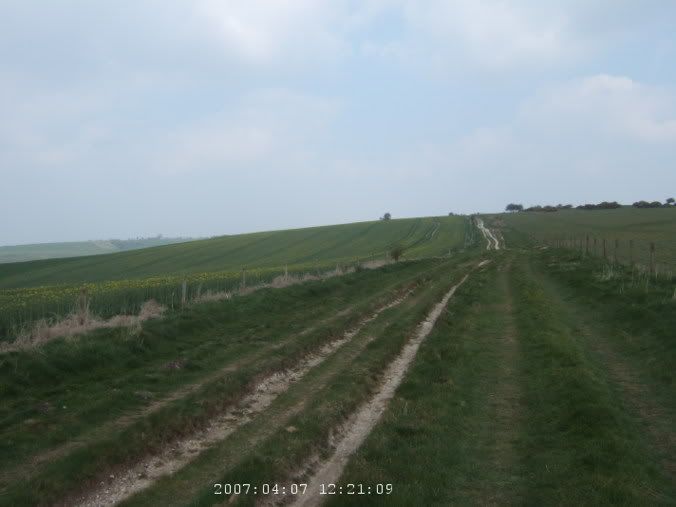
 Road isn't so bad so far.
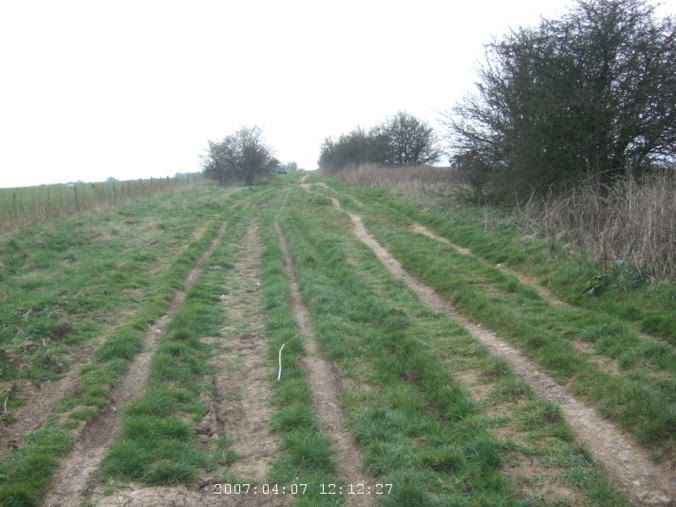
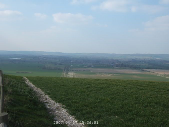
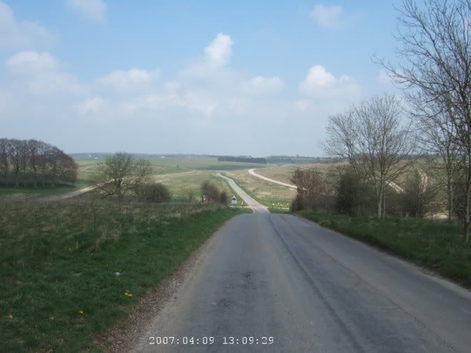
I guess that works ok, I finally then find some road that looks right, although I miss the stone circle marked on it. Oh well, I guess I'll see other ones on the trip. Umm, traffic too, it is driving me a bit crazy. Getting onto the Ridgeway is a real relief. Ok, it is a bad road, but it isn't awful traffic. It is rocky and bumpy and I'm on a road bike. My poor Condor, so mistreated.
 Fields of rapeseed.
It is slow going, can't go all that fast on the road and it takes a lot of concentration to avoid the huge rocks and holes and ruts. (I totally didn't realize at this point that it would get so much worse.) The country side is beautiful though. Rapeseed is blooming all over the place and there are large patches of yellow. Many of the fields are freshly plowed too and they are really interesting to go past. So much of the area here is on chalk, the fields kind of glisten with up turned rocks, a texture of brown dirt and white rocks. The weather is nice too, not too hot but fairly warm, and birds are flying all over.
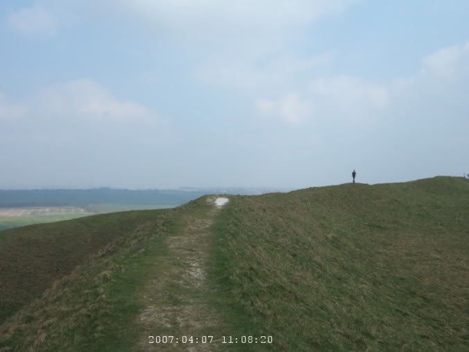
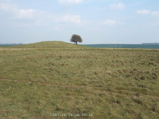
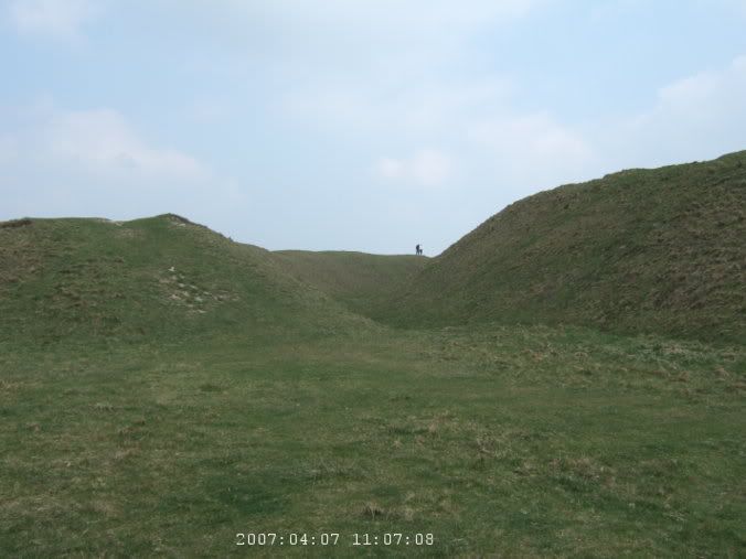 Heading up Barbury Castle. Link
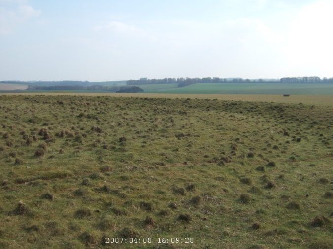
 View at the top of Barbury Castle.
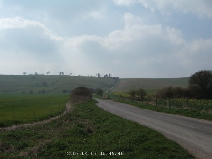
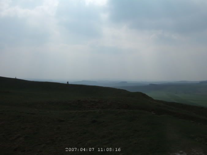
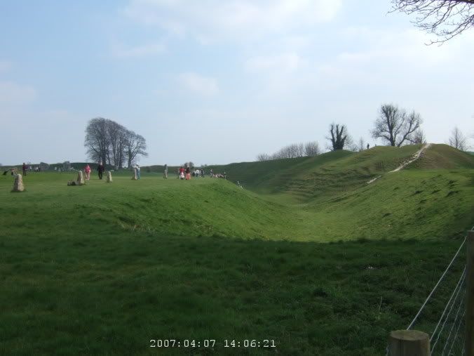
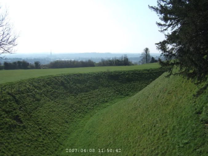
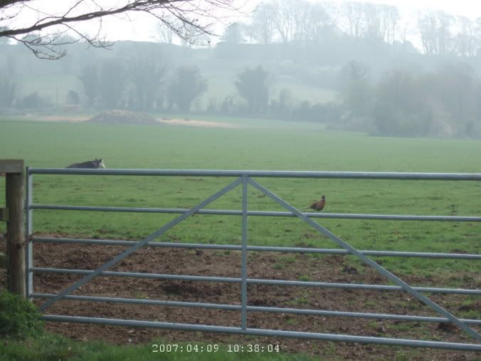
I soon come around a ridge and see lots of cars parked. The Ridgeway crosses a small road here and people are parked to go see Barbury Castle. It is an old Iron Age, I think, earthenwork fort at the top of a hill. I debate going to see it, my bike is a bit loaded down and it looks kind of steep, but I came all this way to see things like this so it is silly not to. It isn't too bad of a hike, pushing my bike up to the top. It is two rings of ridges, with a gully in between and a large flat plateau in the middle. There are a number of people walking around lip of the ridge and I do too. The view is rather nice of the surrounding countryside, a bit hazy though.
I sit halfway around and snack on a few things and consult the map. I'm a little concerned, the road so far hasn't been all that easy and there is a ways to go before I get to normal roads. But at this point, there isn't a lot of other ones that are not a large detour out of the way. So, I keep going. There are not all that many people on this road. Considering how many were at the castle and that this is the first bank holiday weekend of the summer, but there are occasional mountain bikes going by, but not much in general. Some guy does pass me, also a mountain bike but the only one I've seen so far with any sort of baggage on it. He says I'm a bit brave for trying this on my bike. (Perhaps he was being polite by not staying stupid.) A little further on, the road gets pretty awful. The rocky road was difficult but just going over grass with lots of really deep grooves and ruts, with a bike with fairly skinny tires and somewhat heavy bags on the back, I nearly fall once when I get stuck in a groove and can't quite get my cleats out in time.
 Rough going here.
 Even more difficult road.
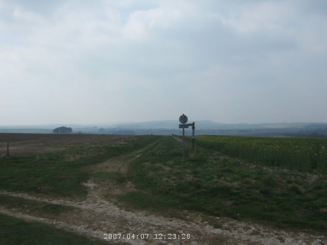 Turn off for the Wessex Ridgeway and to Avebury.
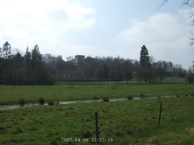
I reach the turnoff for the Wessex Ridgeway, I'm on the home stretch to Avebury now. The road gets somewhat better and is mostly downhill. Then it gets positively better and I find myself around loads of people walking across the street, following the circle of stones around the town.
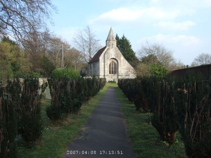
 At the tourist infomation center (old church) in Avebury.
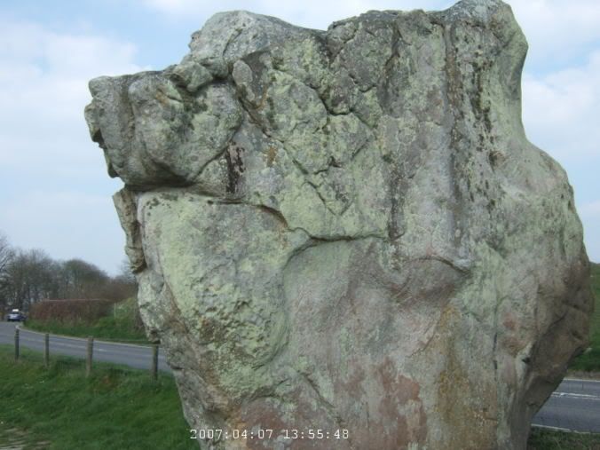
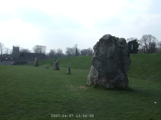
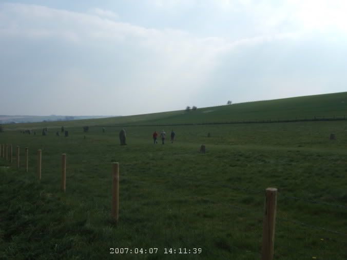
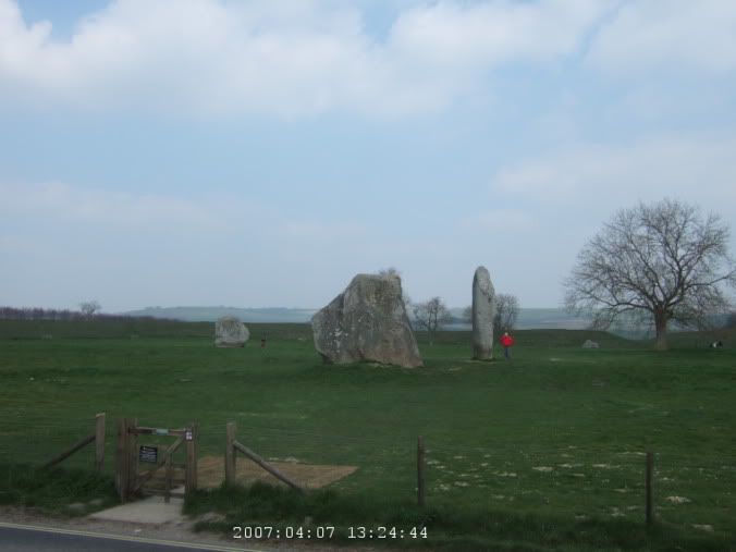 The entire village is ringed by standing stones. Link. Older than Stonehenge and much larger.
Avebury is surrounded by, I guess, the largest set of standing stones, in the world, or something. Most of the village is enclosed by them, along with a henge. I can't see all that much from where I am, just a few scattered stones and lots of people milling around. A church ahead, well, looks to be a tourist information center in a former church. I stop to check it out. Then it is a bit past lunch time and I'm rather hungry and I don't see another candidate for lunch on the map anywhere in the near future.

The pub in town is extremely busy, the parking lot is full and the guy says it will take 45 minutes for food. It doesn't seem like I have all that much choice. They are out of mash, so that dashes the idea of sausage and mash, which is normally a pretty safe pub choice. So, I guess the burger then. Which takes an hour and really sucks. The pub in generally looks pretty crappy but I guess considering their location, it doesn't matter, they probably still make money.
 Avebury St. James church.
 The Stone Avenue, runs for more than a mile.
Feeling not so great from the lousy food, I go and wander around the town a bit, seeing the stones and all. It is a bit hard to appreciate them all, the scale is just so huge. You can't see the entire formation because there are buildings and a town all around them. And it is packed too. So, I wander on then. The Stone Avenue which heads out of town for a mile or so is rather cool, a twin line of stones headed off to another site.
 Past Knap Hill. Link
I keep heading south on some smaller roads. Traffic isn't so bad here and it is nice making good time. I come up to another roadside parking lot and wonder what it is. Well, I saw people off in the distance hiking up a hill before I got there. I sort of figure out it is Knap Hill but I can't figure out what people are going to see (until I got home and saw it has barrows at the top.) I'm amused by the sign that says "Knap Hill has never been and never will be a site for hang gliding" as I see some guy hang gliding off in the distance. Guess he didn't read the sign.

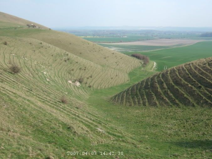
The land around here is pretty cool though. The hills have this really cool texture, like rippling ridges, sort of like a topographical map come to life, the little contour lines, lines across the hills. I wonder what makes them form like that. I keep going, head through Pewsey (which is where I will take the train out in a few days) and at the south side of town, I see the white horse carved in the hill ahead. The really steep hill I'll have to climb.
 The white horse of Pewsey. And the steep climb which I'm heading towards.
But I've decided the whole white horse thing is stupid. This whole area has a white horse trail, which I guess connects the various white horses. I have nothing against them, the man carved near Wilmington, in Sussex, I think, is pretty cool because it is pretty distinctive and is actually rather old. But at one point I see a sign highlighting the various horses in Wessex and none of them are more than 100 years old. Some of them were carved less than a few years ago. Something about that strikes me as annoying.
But steep climb, Pewsey Hill is a big climb and there wasn't even a nice vantage point to stop and enjoy the view once I got to the top. Still, I sat and rested for a little bit. I did realize something there as I went through my snacks. Baklava wrapped in foil is bad. Not because it doesn't taste good, it tasted very nice, but foil is rubbish for holding sticky liquids (or solids that are covered with sticky liquids). Should have been in a plastic bag. My stuff was sticky for the next few days.
 Above the white horse.
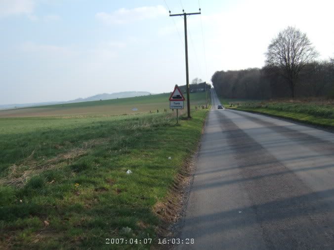 Tank crossing past Everleigh.
 Ahh, a fabulous stretch before Haxton.
Then probably my favorite part of the ride for the day. Past Everleigh, most of this area is owned by the military and I pass 10-15 tank crossings. Didn't see a tank though. But then like five miles or so into Haxton, straight quiet road, slightly downhill, just lovely. And a half dozen or so paratroopers come floating down into a nearby air base.
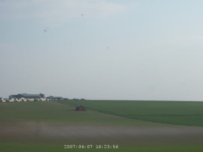 Paratroopers over the RAF air field.
About now, I'm getting a bit tired. There is a B road that follows the Avon but I get frustrated and it winds so much, I can't quite figure out which way I should be going on it, so I give up and just take the A road, which is busy but at least it goes straight and I have a pretty good idea where I'm going. I get really frustrated in Amesbury as I try to find the B road again and end up going in circles way on the outskirts of town and the route seems to be going into some new residential area and doesn't seem to be a through street, so I give up and follow the signs into the center of town and just follow the main road again. It is even busier and is driving me crazy but I'm too tired to go out of my way to find a side road. I'm relived when I get to Salisbury and go past Old Sarum (can't see it from the road but at least I know where it is and I can come back).
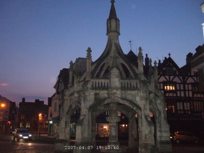
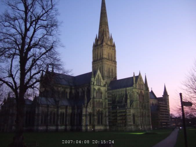
The B&B is slightly easier to find that I feared it might be, it is pretty central. They let me put my bike in the garage and I have a nice cup of tea before I go wandering to find some food. I look at a lot of menus and places before I finally give up and just go into one. It isn't fantastic but I guess it was good enough. I wander down by the cathedral, in the dark, and it is pretty in lit up. Back to the room and I collapse for the night, although the pillow seemed to have some perfume or something on it and it started getting to me in the morning. But I guess like 63 miles today, 7 or so of that in London and probably like 15 or 20 on those really bad roads which were quite tiring. So, I deserve a nice sleep then.
 Around Salisbury.
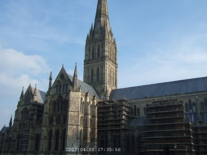
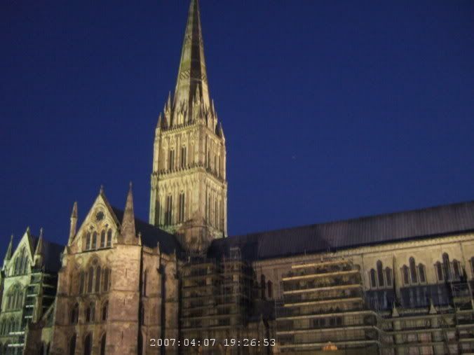 Salisbury Cathedral. Link
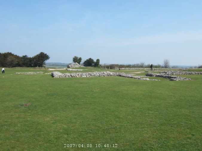
So today I'm planning on taking it easy. I'll go see Old Sarum and maybe goof around town a bit, a little hiking but I don't want to go huge distances, still tired from yesterday. But today, Old Sarum is an intriguing circle thing on the map. Later history that I learned, used to house a royal castle in like 1100 and 1200 and the original Salisbury cathedral which was abandoned when the one in town was built. Hmm, used to be a rotten borough too, sending to Parliament even after nobody lived there.
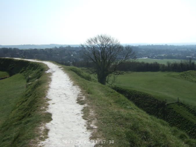
Think I saw a few thrushes in the garden in the morning. Not great with bird identifications, that's my best guess so far. But setting off, much lighter load today, just a single bag with a few things I need for the day. Didn't have any mechanical problems or flat tires or anything on the whole trip, that was good, although I do seem to have an annoying click in one of my pedals now. Tracing backwards from the way I came yesterday and then saw, oh look, a path going along the river, I'll follow that for a while. I believe it was part of a Sustran route, 45 or 24 or something. They are all rather frustrating because the exact routes don't seem to be published anymore and sometimes they are well marked on the roads but at times they just completely disappear and you are lost for a bit.
Up the river, through a park, off into a residential neighborhood, then see a sign for a bridal way heading towards the hill. Time for a hike then. Easy across a pasture and then it starts to climb into the woods. A few times the trees break and I get a nice view of the Avon valley in the distance. I generally try to imagine what it was like for whoever back when. Going through deeply wooded sections of upstate New York and how people moved through that hundreds of years ago. Or what climbing up this hill, through the woods, would have been like in the Iron Age and then later when there was a castle and cathedral at the top.
 The path up to Old Sarum. Link
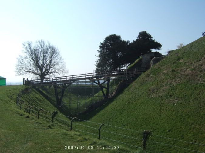
I come to the outer ring of earthenworks and have to continue around until there is a land bridge to the inner ring and proceed up to the plateau at the top with a number of people milling around the ruined foundations of the cathedral and old bishop's palace. A backpacker asks me which way Amesbury is and where the river goes. I point it out, that way, and check the map to double check that I'm actually right. Love the map holder, by the way. I still feel bad about mutilating the OS maps, folding them in strange ways to fit them in there, but it is fabulous having where I am just right there in front of me all the time. Ok, I'm slightly obsessive about maps.
 Outer ring of earthenworks.
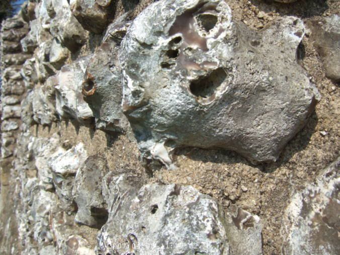
There are a bunch of plaques with blah blah information about what's left, I read them all. The ruins are interesting but not all that much. It is a bit hard to get a sense of it all from just some vague outlines of what is left. But upward to the castle. I get to use my English Heritage card, get to go in for free, across the bridge. The metal scaffolding around it doesn't make it seem very rustic and all, but must be constrained by lots of safety regulations.
 Remains of the old Salisbury Cathedral (which was moved to the center of town.)
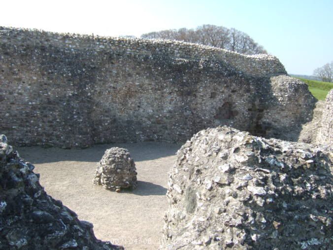
There isn't much left of this castle either but loads of plaques try to give you a flavor of it all, big tower used to be here, royal privy over there, see the pits they used to make people climb down and scoop out, used to be a bridge over there, now you are in the basement of the tower, etc. It is Easter and they have organized Easter egg hunts and things like that (fair amount of people there today). Actually the hunt was huge plastic eggs with letters on them, you find them and write the letters down on a piece of paper. For kids only, what's up with that.
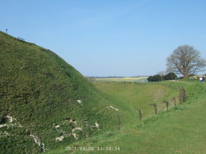 The moat around the castle.
 Bridge to the castle.
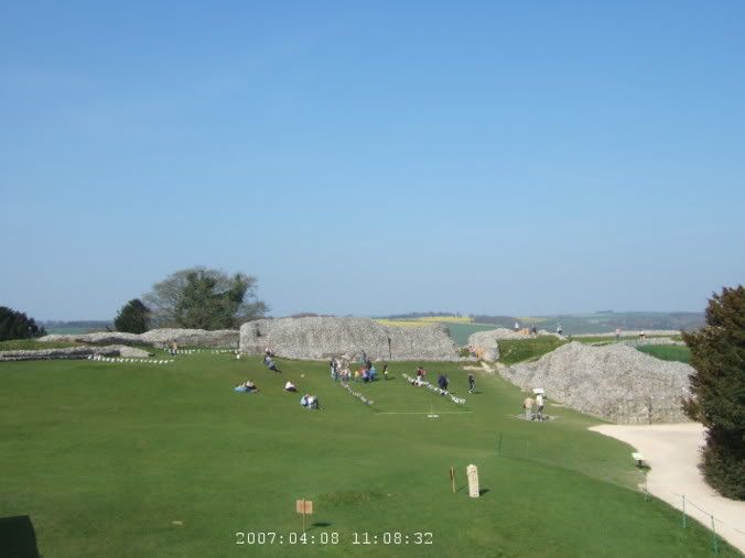
 Remains of the cathedral.
Back on the bike and riding down the steep road on the front of the hill. Not exactly sure where I'm going next, but I saw an interesting looking byway heading north, I figure I'll try that. It is a bit rocky and bumpy but I guess I've already gone through worse, so it is fine. Again, it is a relief to be off the busy roads too. After a mile or so, I figure I'm already headed that way and it isn't all that far, I might as well go to Stonehenge today, which I had sort of thought I would do tomorrow on the way back to catch my train out.
 Heading north from Old Sarum.
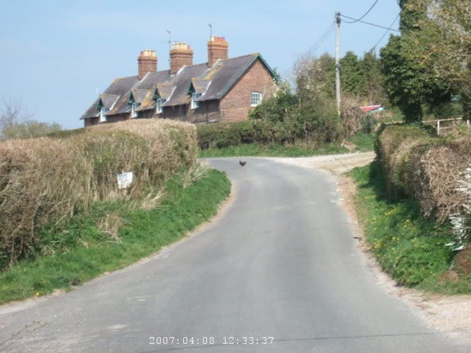 Why did the chicken cross the road?
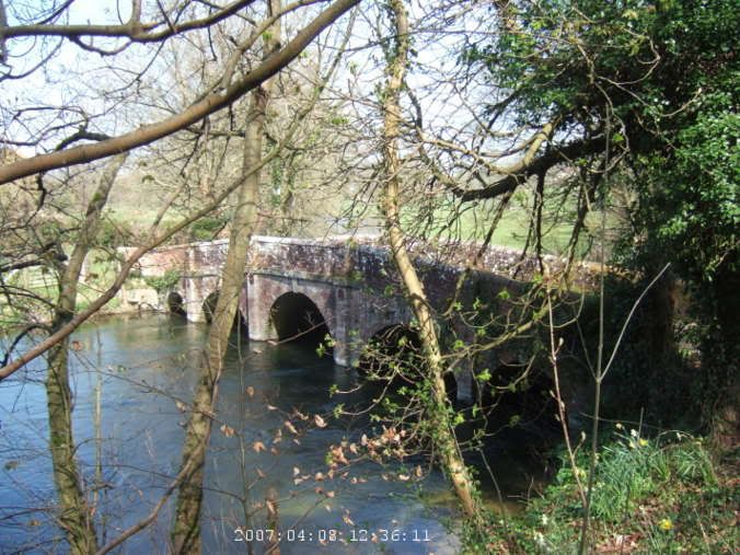 A bridge over the Avon.
I switch to the quiet road that follows the river and it is nice that way for a while. Crossing the river at Woodford, there is an inviting grassy beer garden by the river with a pub. Lunch takes forever to arrive but it isn't like I had a whole lot of choice, a busy Easter Sunday, not a lot of open places to go.
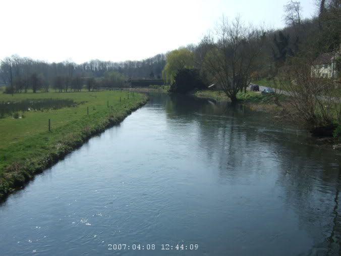 River Avon in Upper Woodford.
At the crossroads into Amesbury, I have a choice, do I go left to Stonehenge or right into town, well, there is a green patch on the map with fort and abbey written on it. The fort, as far as I can tell, was on private land with no access but the church was pretty nice, a fantastic oak door, and an eager volunteer handing me a laminated board with all the highlights of the interior spelled out. The abbey, I'm not sure, maybe it is gone, there was a large retirement home there in a parkland, the building looked somewhat recent, with in the last hundred years or so. Was this the abbey that Guinevere retired to after King Arthur died? I assume that's long gone though.
 Abbey Church of St Mary and St Melor in Amesbury.
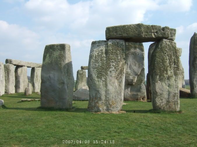
But ok, back to the left then, time to see some big rocks. I was a bit worried about getting there, the map showed the only way to get there is on a major motorway. Luckily there was a path that followed the majority of the way, ending right as I got to Stonehenge. Now, I jokingly had thought before I got there, I've seen Carhenge (a exact replica in cars in a Nebraska cornfield) (Pictures I took of it in 2001) and won't Stonehenge be a bit disappointing after that?
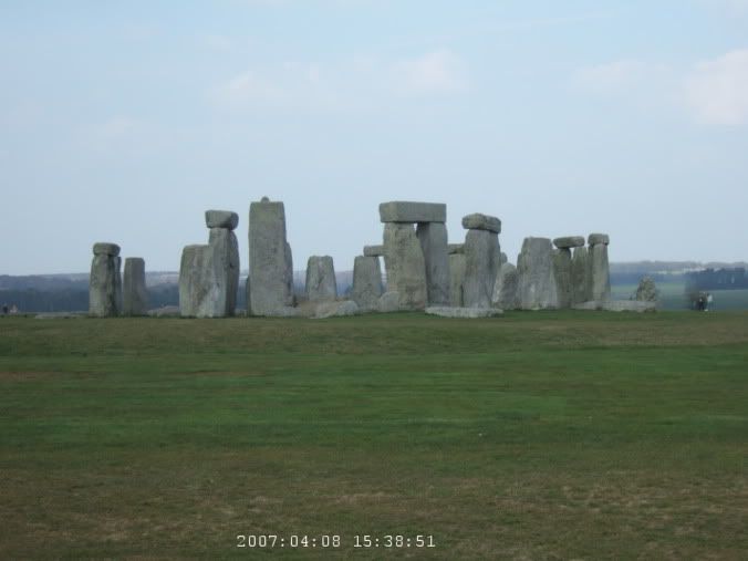
 Stonehenge off in the distance.
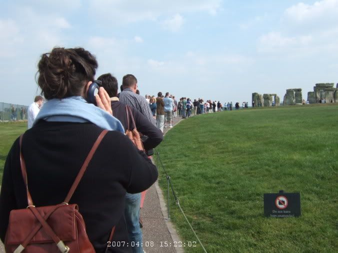
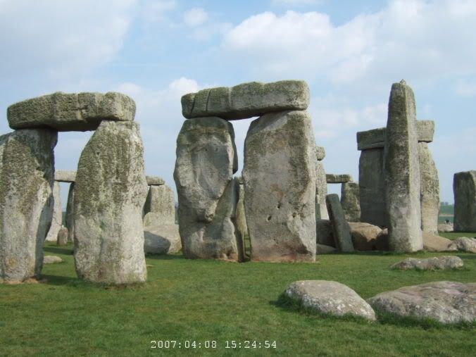
Funny enough, in some ways it was. The whole area is fenced off, there were a few people milling around outside the fence taking pictures through the wires, didn't want to pay the admission price to go in. They have the actual monument roped off and you can walk around it but can't actually get that close. Being able to touch the cars in Nebraska and feel the scale of it, I think that made all the difference. I think it is hard to appreciate the whole feat of the stones and all that from a distance. It would have helped to been able to touch the rocks and feel their weight.
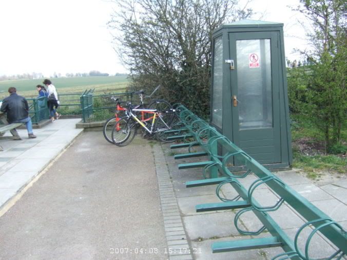 Stupid rubbish bike racks at Stonehenge.
Absolutely rubbish bike racks there too, stupid ones that you can basically lock your wheel up. I already felt a bit freaked out by only having brought one lock with me, not even the heavy one at that, then these crappy racks was the worst. So yeah, free admission with the English Heritage card, underpass under the road and into the fenced off area. They had those little audio guide things but that seemed more annoying so I didn't bother.
 No, I didn't bother getting the audio thing.
 But does it compare to Carhenge? Pictures from 2001
So, you walk around, taking pictures, thinking wow, that's pretty impressive, and then what. There was a flock of sheep in the pasture behind and I have to imagine they are the most photographed sheep in the world. Sat in the back part of the circle for a while, looking at the map, plotting where next then. So enough of Stonehenge then, finished the rest of the circle around and headed out. A couple of cyclist were sitting by the racks, but more on them later. My bike was still there, that's good.
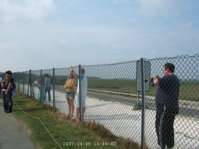 People too cheap to pay the admission price.
Back on the byways then, I take another grassy/rocky path over Wilsford Down, a few mounds and barrows on the way. Back to the main roads, a nice fast ride down to Stoford and down into Wilton. So again in town, a slightly lost, the roads themselves don't bother to tell you, I'm the red road on your map, that's the yellow one over there, and you shouldn't go on that one there since that's the green one. And no green dots anywhere for a Sustrans road. I go by Wilton House, and peek in the gate, seems pretty but it is probably closed by now and I don't care all that much. Then there is a church tucked away on the corner of a busy intersection, St. Peter, Fugglestone, parts of it dating back to the 13th Century.
 Barrows.
 Past Wilton House.
On my way out the other side, there are a few cyclists across the street yelling and waving at me. They have lost the rest of their group and the Sustrans route, do I know where it is. Checking the map, probably there but I'm not sure. The rest of their group shows up (some of them from Stonehenge earlier) and I'm briefly adopted by them on the few miles back to Salisbury. The route back is actually fairly nice and mostly quiet and they are pretty fast.
 Church of St. Peter, Fugglestone, Wilton. link
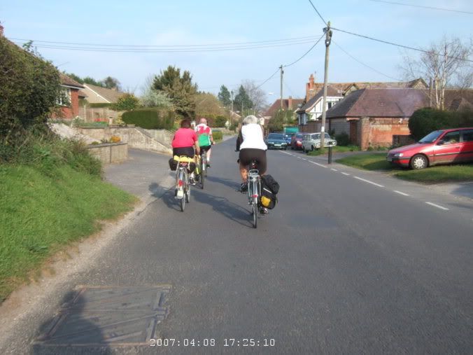 Briefly adopted by this bike group.
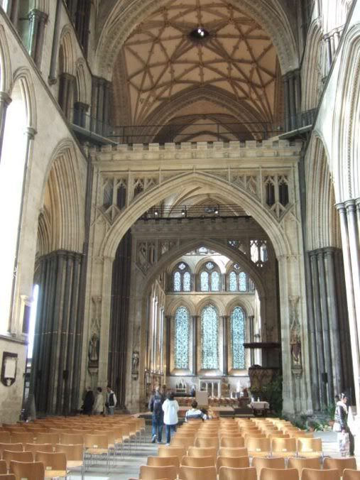
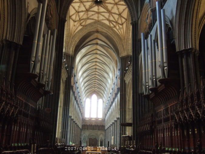
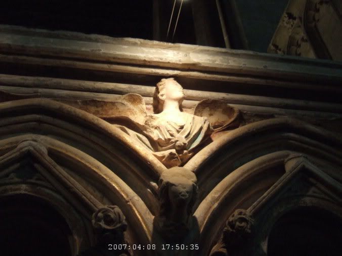
In Salisbury, I break off and head down towards the cathedral. I didn't think it would still be open but it was. Part of it was closed so I couldn't see one of the four surviving original copies (hmm, original copy) of the Magna Carta, oh well. The cathedral is impressive inside, a bit odd for a cathedral since it was built in a single 40 year or so period, so unlike most cathedrals built over centuries, it is built in a single style. There is a cool old 700 year old clock too.
 To Salisbury Cathedral.
 Model of what Old Sarum would have looked like in the 13th Century.
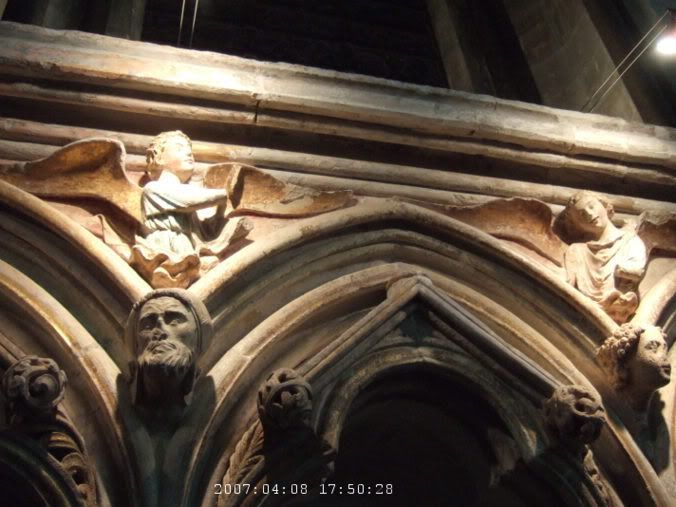

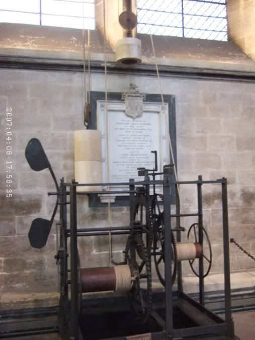 Fantastic old clock.

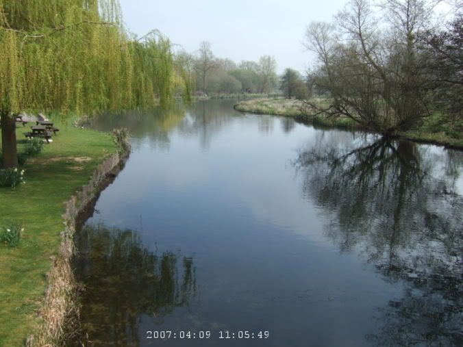
On the map, the area to the south of the cathedral looks intriguing, bits of blue stripes of water with the Old Mill at the end of it. The area is water meadows, marshy with channels cut through them to drain and move the water around. It is also the area that Constable painted a few pictures of the cathedral from.
 Down south towards the Old Mill and the water meadows. Constable painted around here.
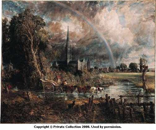 Salisbury Cathedral from the Meadows John Constable - 1776 - 1837 - Constable exhibited this painting at the Royal Academy in 1831, but continued working on it during 1833 and 1834. One of his last major landscapes, it represents the culmination of his numerous treatments of Salisbury Cathedral. Constable's 'Salisbury Cathedral from the River' was painted about a decade earlier around 1820. Salisbury Cathedral is seen here from the north-west, with Long Bridge over the River Avon on the extreme right. The most striking feature of the composition is the arching rainbow. However, Constable appears to have introduced this at a late stage in planning the picture. Much of the atmospheric effect of the painting is achieved by Constable's extensive use of the palette knife in addition to the brush.
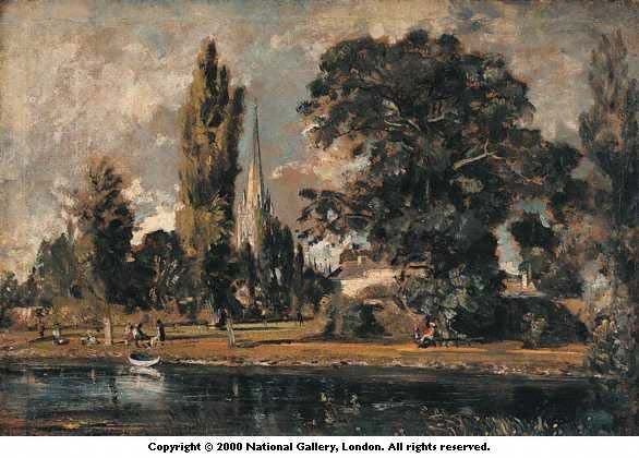 'Salisbury Cathedral and Leadenhall from the River Avon' In the foreground, the River Avon; right, the Canonical House, Leadenhall, which Constable's friend, Archdeacon John Fisher, was granted for life in 1819; left, the grounds of King's House in front of the Cathedral spire. The painting was made when Constable stayed with Fisher.
Back to the room to drop my bike off and go searching for food. I walk for a long time, end up back down by the Old Mill again, thinking I might eat there but the place looks all fancy and I wasn't really in the mood for fancy. Back into town and wandering more, getting late, worried that things might be closing, just go into one place, which also turned out to be somewhat fancy and it took forever. I made the mistake of starting to read my book again halfway through dinner and when the waitress came and tried to grab my plate, hey, I'm not done yet. So, she didn't come back for a really long time after that. So, I sat and sat and sat waiting for my bill but she seemed to be ignoring me, although she was running around like crazy most of the night. 30 minutes later, I'm so very tired, it was such a long day and now sitting here forever. I never know if you are supposed to tip people, sometimes they sneak it in the bill, sometimes they say not to, but here I just wanted to go to bed, the card/pin reader didn't ask if I wanted to leave one, I just wanted to go to sleep.
 Back to the cathedral again near sunset.
Back to the room, soon asleep.
Wake up, vaguely pack things and then breakfast. Same one as yesterday, I guess that's the system, make the same thing every day, less thought and work. None of it was really cooked, so I guess that would make things a lot easier. I would have been happier with a full English, but I guess this one will have to do. The other couple in the dining room figured I must have been the one with the bike in the garage. I noted theirs since one of them was also a Condor. He came as sort of part of a group and I think she just came along too. We talked about our frames and she grabbed the key to the room and fled. I saw them later as I was leaving, they were packing up their car, tying the bikes on the back. Poor sad bikes, they probably spent most of the trip in the garage and then back on the back of the car again for the trip home.
Last bit of packing before I leave. I'm determined to discover a system that makes sense, what goes where in the bags and which on what side. So, then later if I'm looking for something, I know where to find it. A silly dream though, I doubt I'll ever find it. Might as well pretend I'm going to also discover the perfect lightweight rain jacket too. Ahh, dreams.
I don't know what I'm going to do today yet. Well, I know I have a train at 8:30 in Pewsey, about 20 miles away or so. But what to do between now and then. I guess I'll follow the Wiltshire Cycleway and see where I end up.
 Going north past Old Sarum.
 Hazy day
 Going through Woodford again.
So quickly through Salisbury, past Old Sarum, winding roads along the Avon, much hazier than the other days but eventually got quite warm later in the day. Was making good time, found the way back through Amesbury that had defeated me on Saturday. A bit annoying, I was pretty close to the right place and ended up backtracking and going in a circle. Oh well, wiser now.

There was supposed to be an 18th Century dovecot but I must have gone right past it. A bug had gone into my eye and I had to pull off the road before Netheravon and cry a bit and see if I could get it out. That's probably about where I missed it. By the time I got to Netheravon, I didn't really want to go back and look. The church there was nice, but it was locked up. There were instructions on where to go find a key, but I didn't want to ride around knocking on doors.
 In Netheravon, really tried to find the 18th Century dovecot, but I must have missed it somewhere.
 Netheravon church.


And then back to the nice stretch from Saturday, although it was slightly uphill this time, and there were only about 5 paratroopers floating down this time. It was getting positively hot and it was time to switch to shorts for the rest of the day. Past the tank crossing zones, never did see a tank, and into Everleigh, ready for lunch. It is that bit of indecision, lock the bike, take the bags, where do you put the bike, all those questions. I put it behind the fence in the beer garden, lock it to itself and leave the bags and head in. Odd, this pub is a Rhodesian themed one. I have the standard lime and soda (although hardly any lime in this one), beer is too tiring if you have a long way to go, and order a Rhodesian sausage sandwich. Not really sure what was in it but it was fairly good.
 Back to the tank crossings north of Haxton.
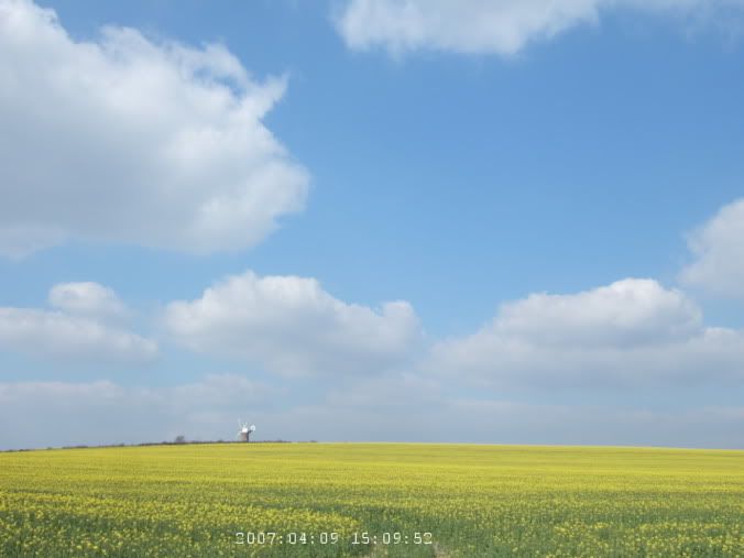
After lunch, there wasn't a whole lot that was overly exciting for a while. The Wilton Windmill seemed like an interesting point on the map to shoot for and it was actually rather nice. It sat on top of a hill covered in blooming rapeseed, so right in the middle of a sea of yellow. The road went by fairly close to it but it didn't seem all that worthwhile going for a closer look. It seemed like it was prettier from a distance.
 Wilton Windmill.
It was a bit after this that I started to lose my ambition. 30 something miles so far, I could head straight for Pewsey but that would put me there hours early. Might as well follow the loop around, see if I can swing by Marlborough, it is supposed to be interesting. But by the time I was around Froxfield, I was wondering if I really wanted to. But there wasn't really a good way to bail out without going on some horrible big roads, so I guess keep going then.
 Crossing the Kennet and Avon Canal at Great Bedwyn.
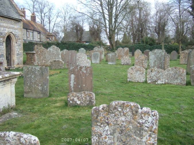
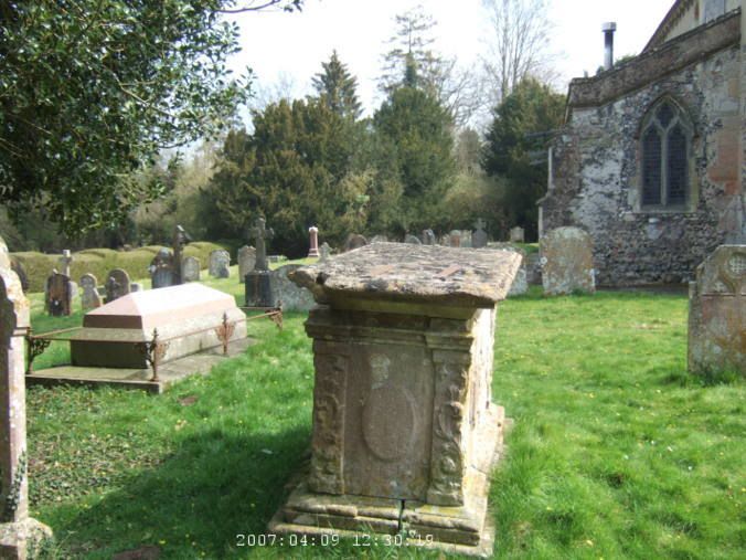
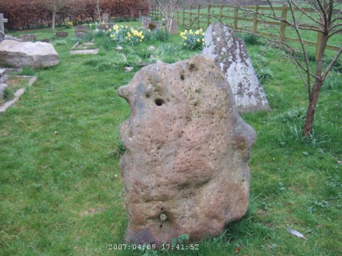
Eventually to Marlborough then. At first it was rather unexciting. A medium sized town with lots of busy traffic. Oh well, I can check it off the list, been there. Trying to get out of town by the most reasonable route, I happen by Marlborough College and it has a nice looking church. Walking around it, there is a white horse on the hills behind, kind of tired of the white horses now. But then, just past the college, really wanted to get off the busy road and just took a chance on what looked like a footpath, cross the river and ended up St George's Church Preshute. Such a pretty find, black and white checkered, slate and all that. Probably the prettiest church on the whole weekend. And it had the best graveyard too, the most interesting stones. The ones that were really fabulous were the sandstone ones which looked like they have started to melt and dissolve, which I guess they kind of have done.
 The chapel at Malborough College.
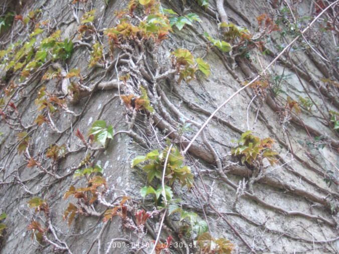
 A pretty wall with a tunnel.
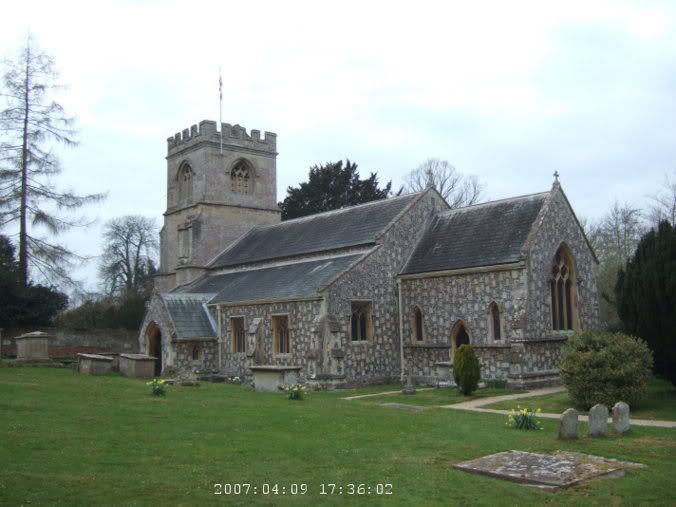 St George's Church Preshute, probably the prettiest one I saw. Link
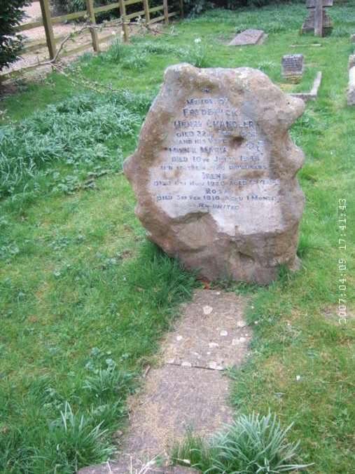
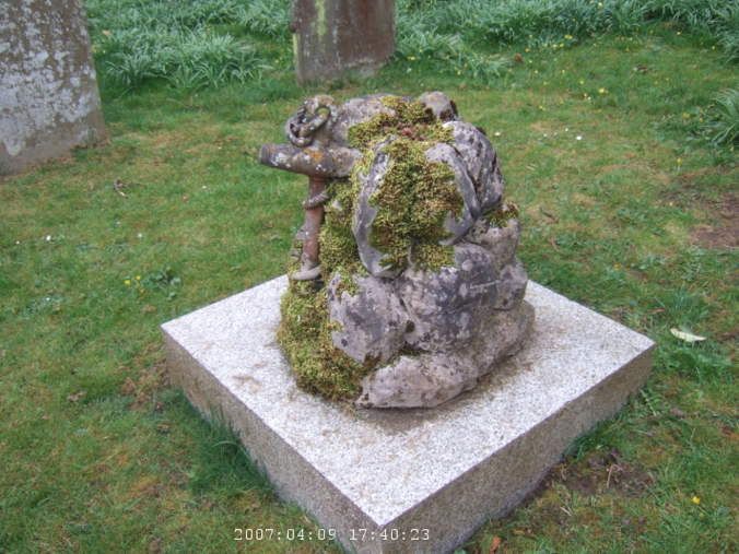 And the most interesting graveyard.
Some back roads and trying to get the short distance left to Pewsey as nicely as possible, I make it there with about two hours before my train. There were quite a few pubs in town, I wandered around seeing which one seemed the best. I just never know though. But I picked one and it was fine. For dessert, I really wanted something with custard, they kept coming back from the kitchen telling me they didn't have this sort of sponge or the apple crumble was off. On the third time they finally came up with a chocolate one, which was way too choclolately but at least I had custard. They came and chased off the fat old dog who kept coming and lying under the table, no doubt hoping I would be generous with the food.
So, train home then. Keep in mind that I have already gone way out of the way to get my bike there, stupid engineering works and bus replacement messes. So, sitting down to wait, the sign says "regret, no handicap toilets", umm ok, "regret no cycle spaces", umm, no, that's not going to happen, I have a cycle reservation, I even have the ticket for that printed out and everything, and on top of that, I have first class ticket (due to the completely incomprehensible system of pricing of rail travel, that was far cheaper than any other ticket I could get. I did do a quick price comparison of how much the electronic ticket kiosk would have charged me if I had bought a ticket then, a lot more, so I felt ok about it then.)
But yeah, another cyclist showed up and we discussed our impending yelling fit to get our bikes on the train. Then the time changes on the train, delayed, that time passes, it moves to 15 minutes later. Finally the train pulls up and the guard is poking his head out the window and yells no bikes at us. We calmly but firmly discuss having cycle reservations, it being the very last train to London for the night, and basically just keep moving toward the train with every intent of going home now and on that train. Finally he relents and says to just put them in the passageways. (Must remember to write a note to First Great Western questioning their whole useless system of cycle reservations.) Then having to sit there, watching my bike bounce around in the passageway as people tried to get past did mar the whole first class experience a bit, but at least I was headed home.
So, off at Paddington, a long trek home across London. And then yet another bike has popped up in the bike storage closet in my building, so I have to spend 5 minutes moving things around trying to get mine in there too. So, finally off to bed, dump my bags out on the floor to get what I need and I'll deal with the rest of it tomorrow. 63 miles today, 157 total for the whole weekend.